
Monashees: Mt. Fosthall via Spectrum Lake
Monashees: Mt. Fosthall via Spectrum Lake
Cherryville
55 min from Frank's General Store in Cherryville, BC
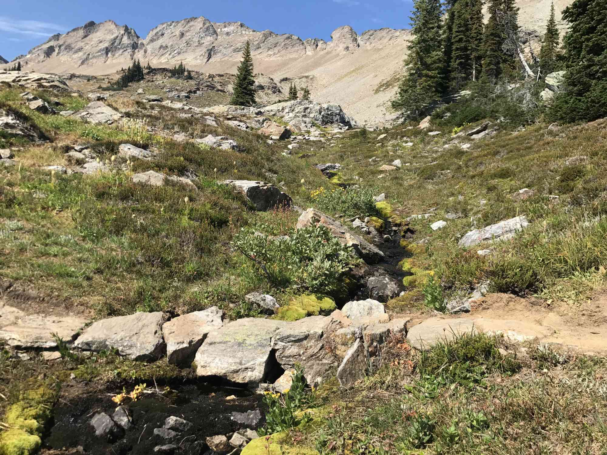
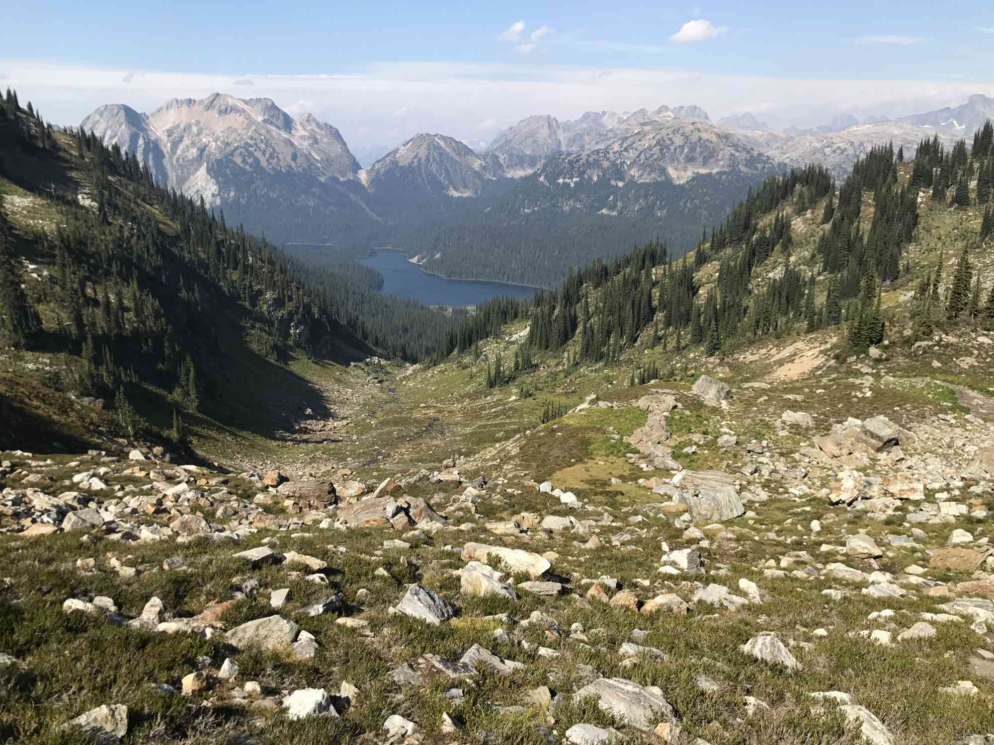
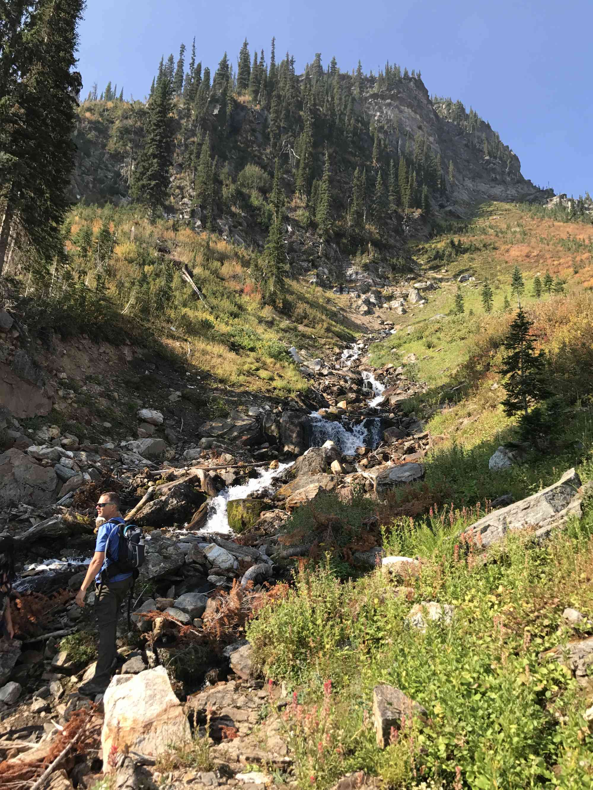
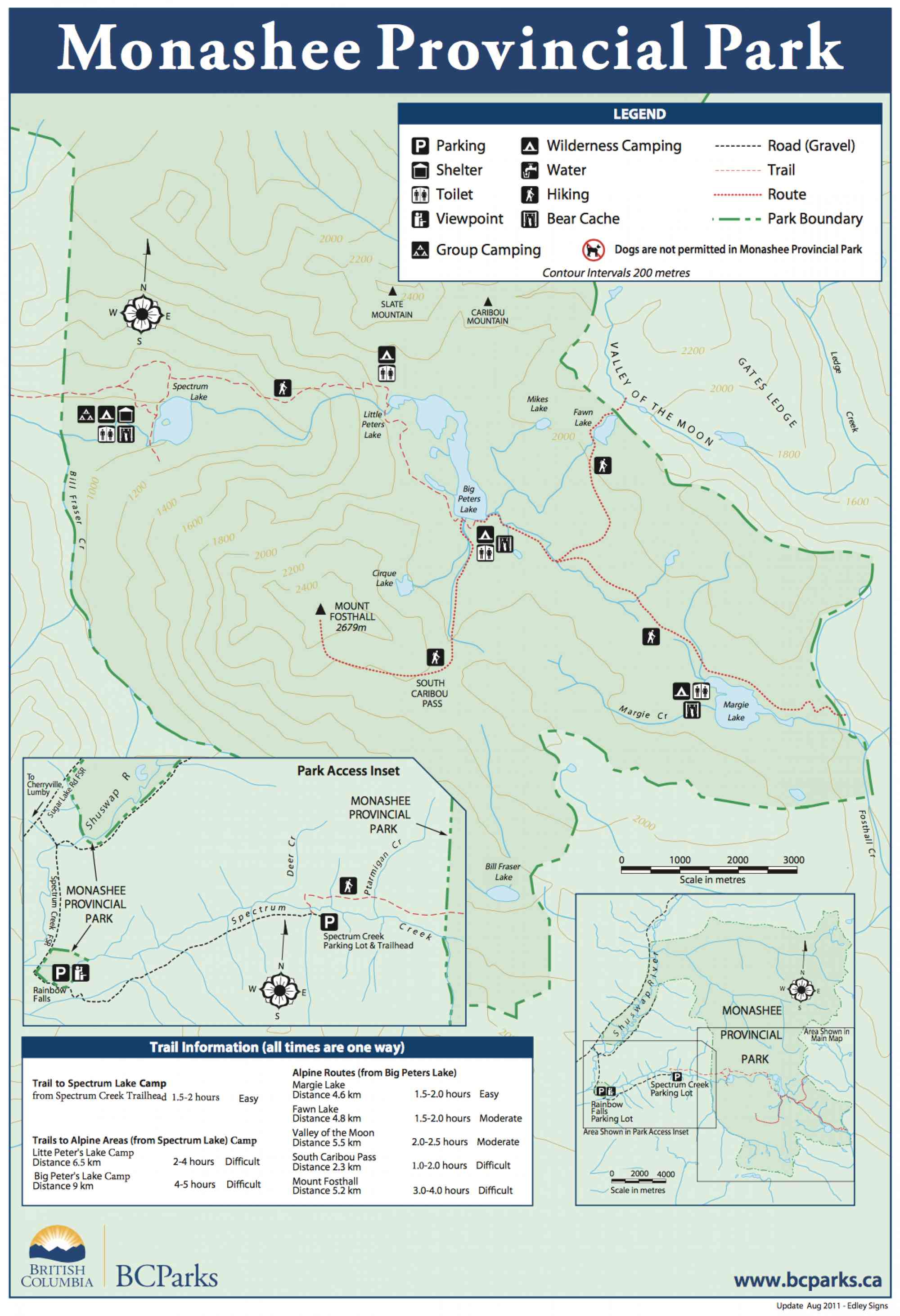
50.503809, -118.360580Begin the trail meandering through the foothills of Mt. Fosthall at Spectrum Lake which offers a vast diversity of coast-like flora. Rich green moss coats the valley floor, and numerous creek crossings. Spectrum Lake is rich with rainbow trout and offers a fantastic day hike for families with children.
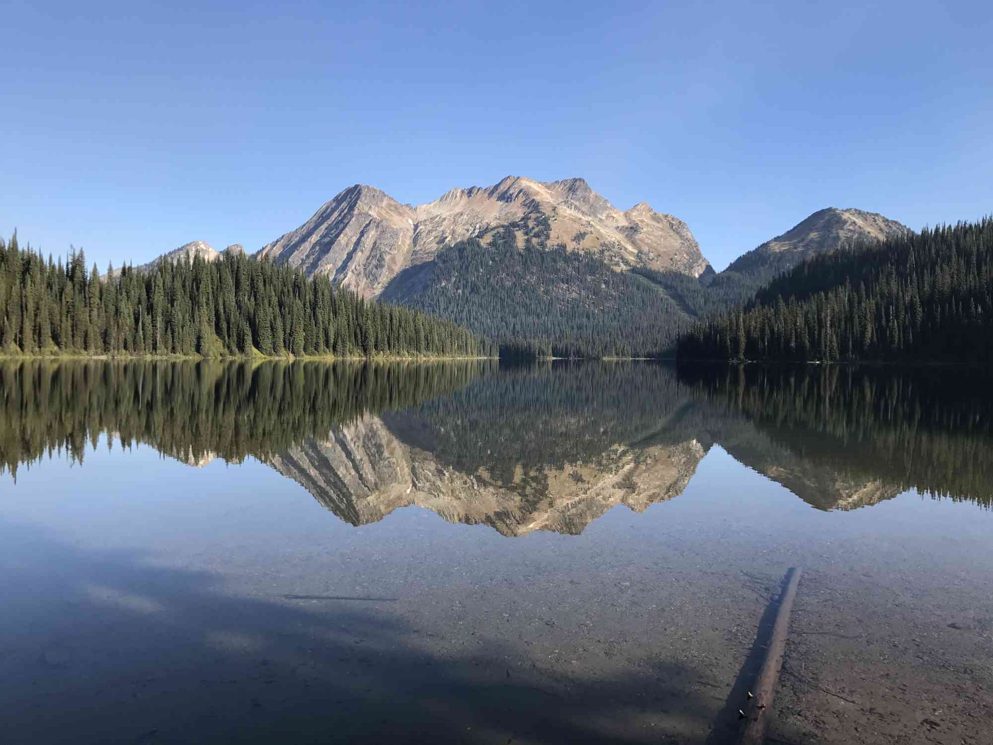
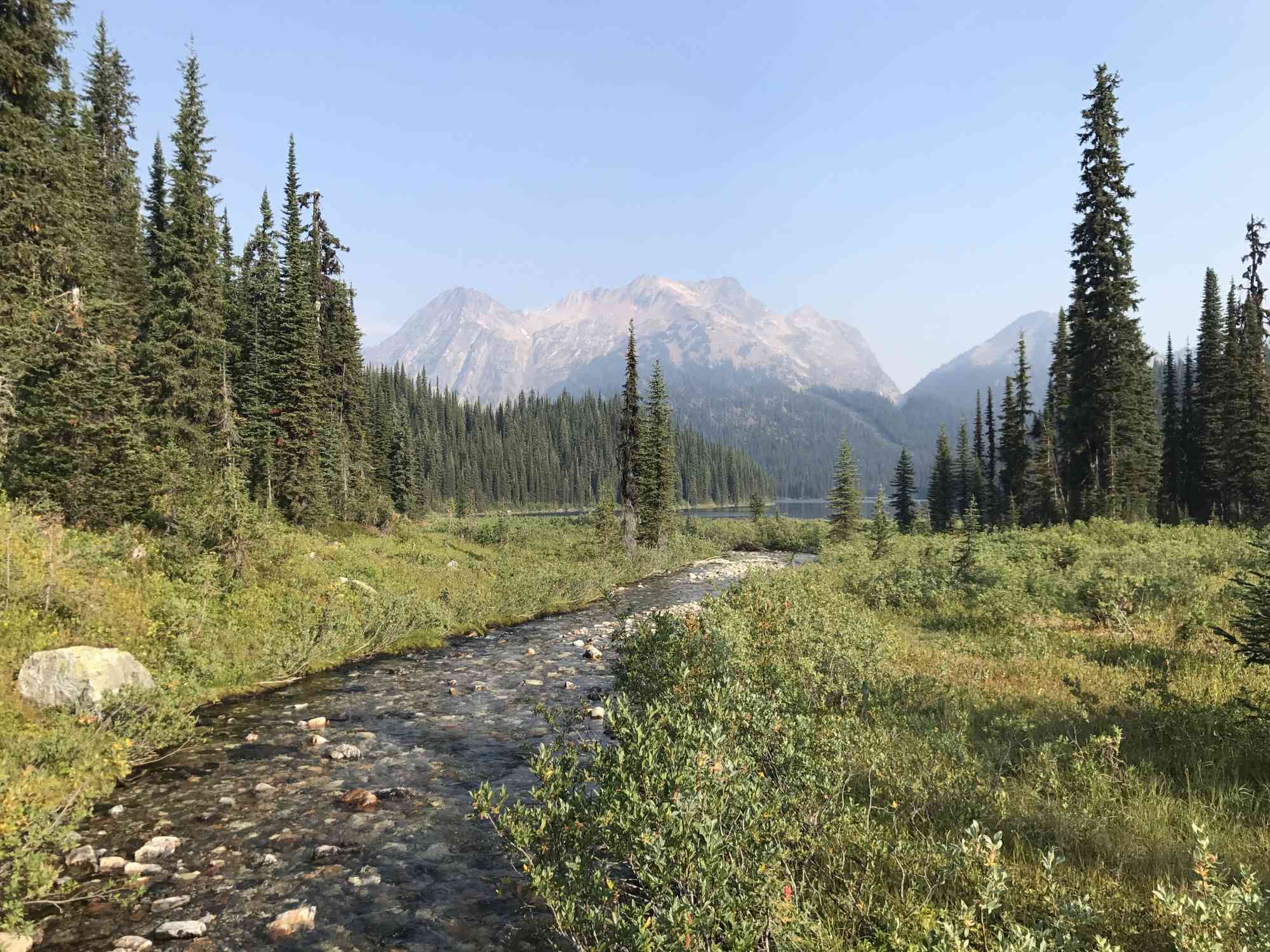
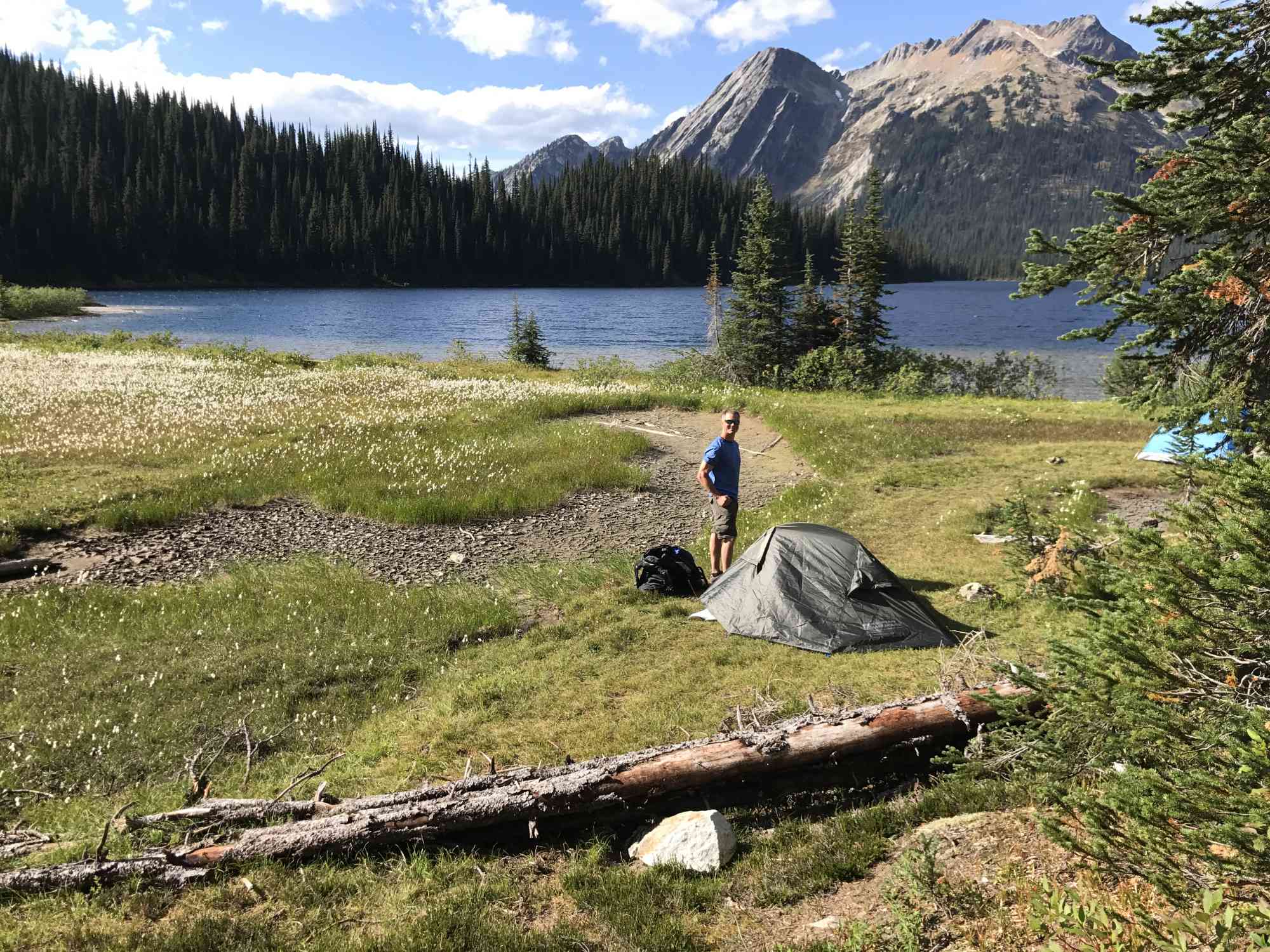
For the more adventurous, head up the gruelling ascent to Little and Big Peters lake, indulging in the huckleberries, blueberries, and thimbleberries along the way. This is where the well maintained trail ends. Set up camp at the stunning Big Peters glacier-fed lake, complete with bear cache, ranger's tent, fresh stream water, and lakeside backcountry camping. This can be done in one day, but we do not recommend doing the summit of Mt. Fosthall on the same day.
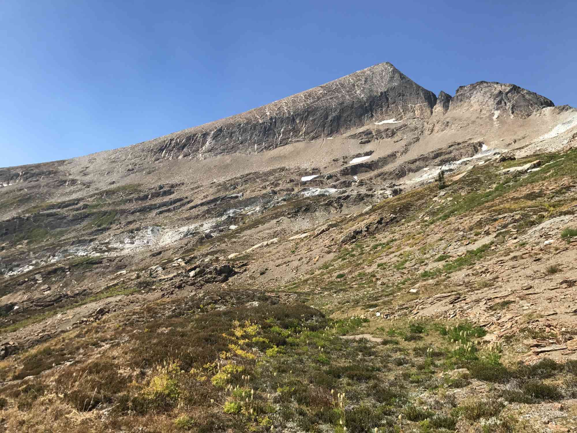
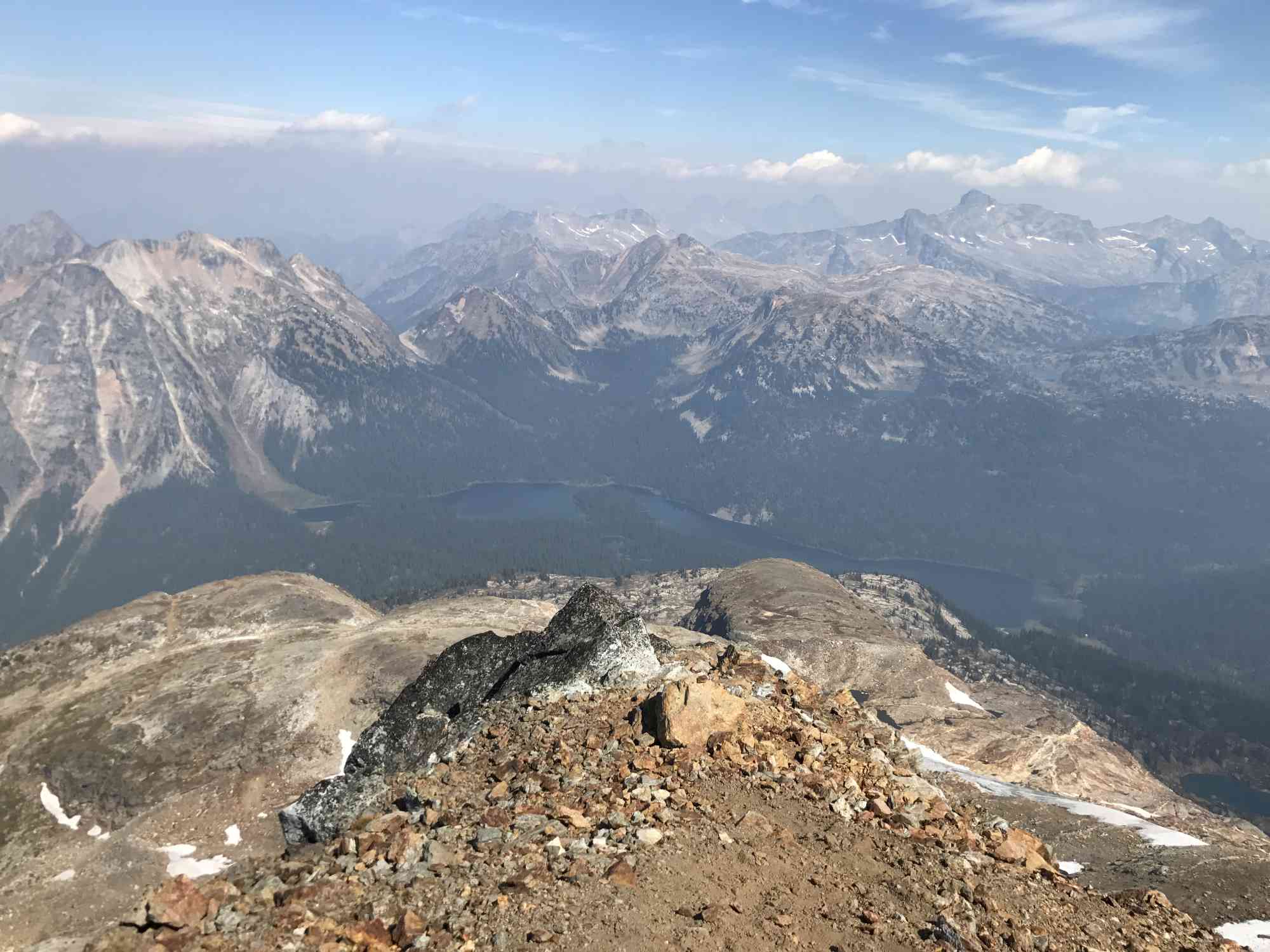
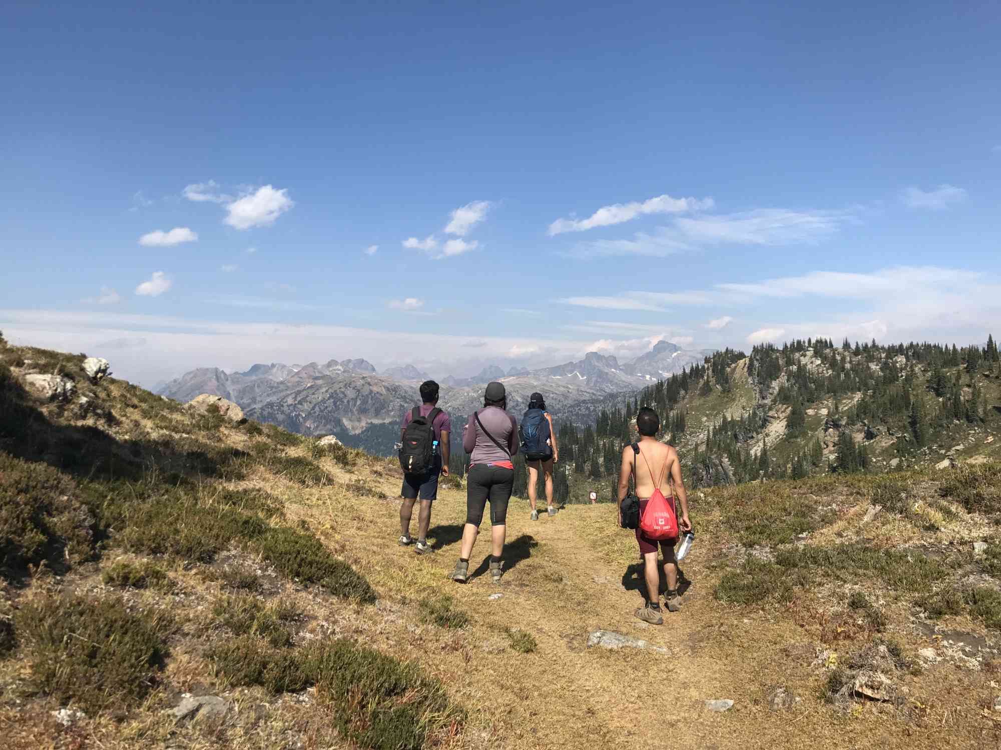
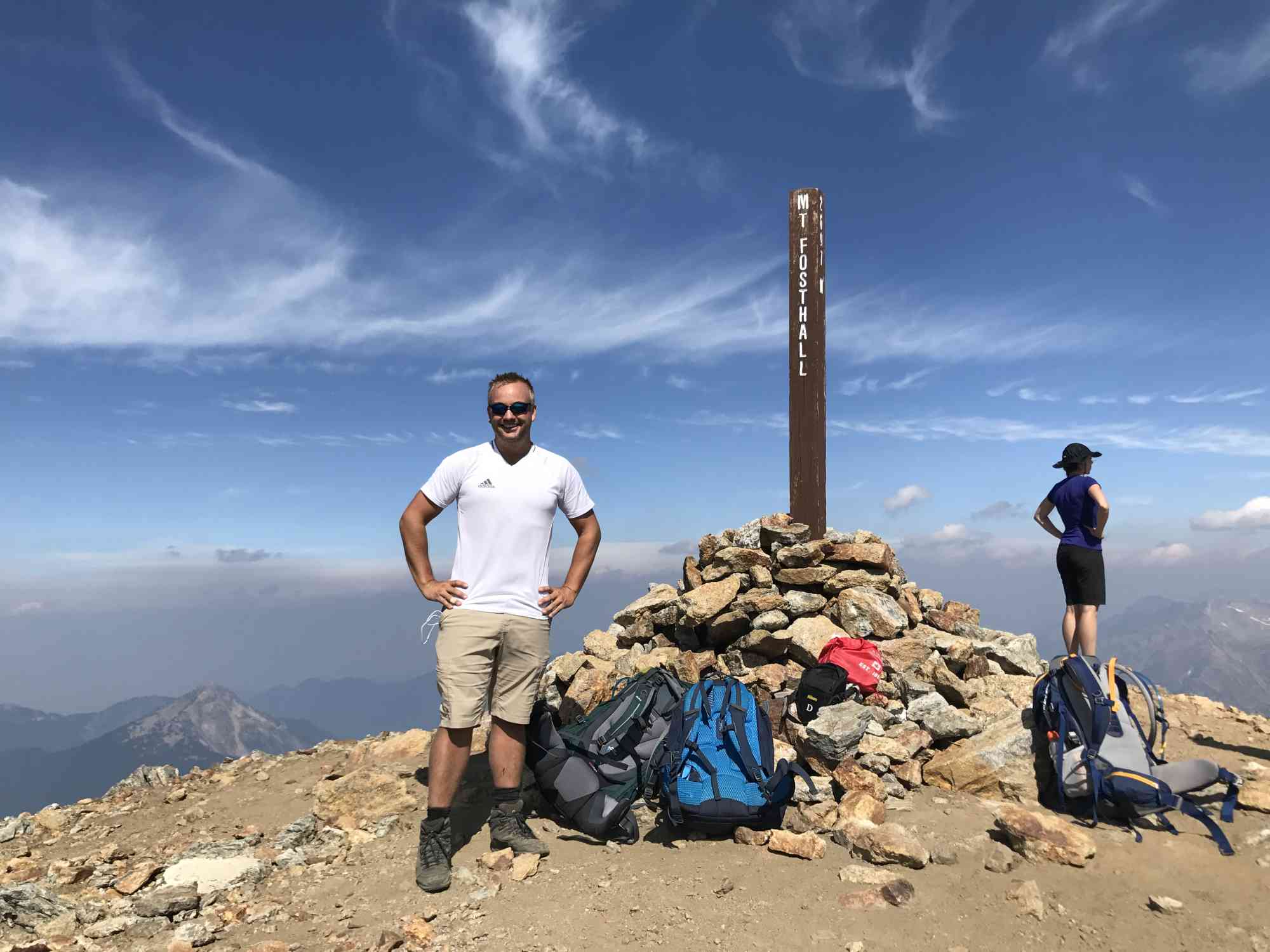
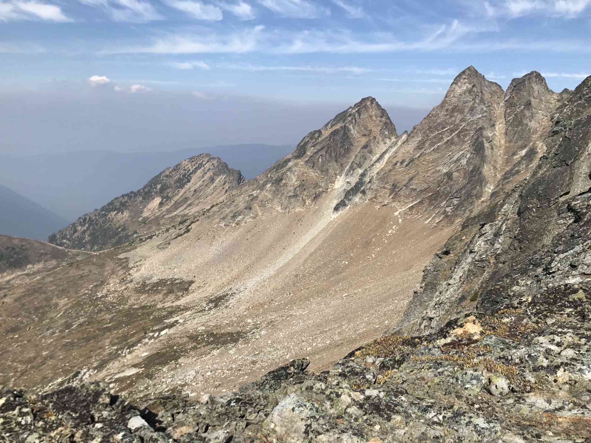
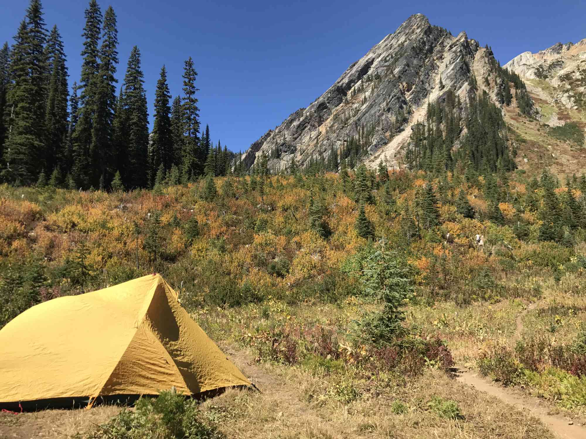
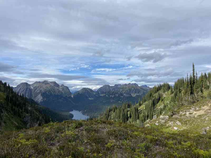
Reaching the summit of Mt. Fosthall from Big Peters will take between 3 and 3.5 hours and is a way-finding route only. There are some cairns along the way, but advanced trail sense is required to navigate. Follow the stream and valley up to a well maintained bike path as part of another resort on the far/south side of the mountain. After following this trail for a few minutes, keep an eye on the ground for a large stone arrow and head off-trail to the right. Meander through the alpine meadows and take a self-guided route to the summit of the giant ramp-like Mt. Fosthall adorning the skyline.
Even in the hottest months, there are plenty of refill options available for water. The best time to hike Mt. Fosthall to avoid snow and horrible weather is the month of August up until mid-September.
For fit adults with a large overnight backpack hiking times are as follows. Please let us know your times!
* Parking lot to Spectrum is 1.5 hours (5 km from trailhead)
* Spectrum to Big Peters is 4 hours (14 km from trailhead)
* Big Peters to Mt. Fosthall is 3.5 hours (20 km from trailhead)
For the more adventurous, head up the gruelling ascent to Little and Big Peters lake, indulging in the huckleberries, blueberries, and thimbleberries along the way. This is where the well maintained trail ends. Set up camp at the stunning Big Peters glacier-fed lake, complete with bear cache, ranger's tent, fresh stream water, and lakeside backcountry camping. This can be done in one day, but we do not recommend doing the summit of Mt. Fosthall on the same day.
Reaching the summit of Mt. Fosthall from Big Peters will take between 3 and 3.5 hours and is a way-finding route only. There are some cairns along the way, but advanced trail sense is required to navigate. Follow the stream and valley up to a well maintained bike path as part of another resort on the far/south side of the mountain. After following this trail for a few minutes, keep an eye on the ground for a large stone arrow and head off-trail to the right. Meander through the alpine meadows and take a self-guided route to the summit of the giant ramp-like Mt. Fosthall adorning the skyline.
Even in the hottest months, there are plenty of refill options available for water. The best time to hike Mt. Fosthall to avoid snow and horrible weather is the month of August up until mid-September.
For fit adults with a large overnight backpack hiking times are as follows. Please let us know your times!
* Parking lot to Spectrum is 1.5 hours (5 km from trailhead)
* Spectrum to Big Peters is 4 hours (14 km from trailhead)
* Big Peters to Mt. Fosthall is 3.5 hours (20 km from trailhead)
Route
Kids & Pets
Features
Address
Driving Time
From Frank's General Store in Cherryville, BC, approximate travel time by car is 55 min.
Notable GPS Co-ordinates
Detailed Directions
1) Drive to Vernon, BC from downtown Kelowna.
2) Take RIGHT on Highway 6 and then bear right to stay on Highway 6.
3) Around the 50 km marker since the turn in Vernon, turn LEFT at Frank's General Store in Cherryville onto "Sugar Lake Rd"
4) RESET ODOMETER
5) At 13.6 km, the road becomes gravel.
6) At 16.6 km, cross the bridge over Sugar Lake. The road now becomes "Shuswap FSR"
7) At 38.2 km TURN RIGHT with signs for Monashee Provincial Park via "Spectrum Creek FSR"
8) At 39.4 km, keep right to stay on main rd (following signs)
9) At 42.3 km, keep right. Alternatively, a short 1 km drive + 10 min hike to Rainbow Falls is on your left.
10) At 43.5 km, keep left to stay on main rd (following signs)
11) At 44 km, keep left to stay on main rd (following signs)
12) At 45.6 km, keep left to stay on main rd (following signs)
13) At 51.7 km, arrive at the parking lot with map and signage for Monashees Provincial Park.
Google Directions
Use our written directions in preference to the Google directions below as they are likely more accurate.
Linear Trail
We have a downloadable GPS map for this trail!
Last Updated on Thursday, March 23, 2023
Need help using it? See our FAQ.Map Waypoints
GPS Notes
Daughter and I topped out August 4th, in a blazing blue sky with nearly no wind. Summit views are 360 degrees and breath taking and cell reception was excellent. I hadn't been up to Peters Lake since the mid-90's and the trail is every bit as steep as I recall. And relentless. But it is very much worth the effort. Bugs were wicked so we set up camp, ate and hopped in the safety of the tent for card games and an early night. Night sky was very much worth waking up for in the dark. Our ascent was nearly de-railed by someone moving a Trail post - we found it at the saddle, having climbed up from Peter's Lake, which didn't make sense and pointed us straight up the eastern ridge. We proceeded around the first ridge and then turned off the S Caribou Pass trail to meander up a meadow as all route descriptions state but ended up topping out on the east ridge only to see the unmistakable Mt Fostall still far off in the distance. We escaped the ridge by lowering down into the south bowl where we should have been in the first place but at least one other party we met upon our return to Peters Lake had to abandon their attempt as they had no rope nor any protection with them at all. After summitting an hour after our ridgeline adventure my daughter and I returned through the proper approach only to discover the sign post had already been relocated to its proper place. The South Caribou Pass is frequented by mountain bikers and we suspect one of them replaced the sign post to its proper location, so thank you to whomever did that. No idea who thought moving it to the saddle was a good idea; thankfully no one was put in serious jeopardy as a result. There is no sign of a stone arrow pointing the way off the S. Caribou Pass now but the signpost, when in its rightful location, clearly points the way. If you don't see the unmistakable ramp of the southern ridge, you're not in the right place; keep to the main trail just a little bit longer and you will see it. Once again, peak wild flowers and just a wonderful place. We descended all the way to the parking lot same day, which is a pretty massive effort. Taking a second night would be ideal.
Thursday, August 15, 2019 at 12:54 PMLeave a comment
You must Login to post a comment!