
KVR (Kelowna to Naramata)
KVR (Kelowna to Naramata)
Kelowna/Naramata
** This trail is a CYCLING trail. While it can be hiked, the duration listed is for cycling. **
This is a relatively casual ride from Myra Station all the way through to Naramata, BC. Plan for 5 hours for a moderately active adult at a steady pace the entire time with minimal breaks. Your pace will make or break you on this trail. For a nice, easy, ride plan for 6 hours on-trail. 65 km is a very long cycle for the day, so prepare yourself by bringing at least 2 litres of water, snacks, and a very soft bike seat! The trail gets somewhat bumpy at parts, so you'll be dodging potholes here and there. Also, ensure you bring a regular mountain bike; a city bike won't cut it due to some sandier sections.
The stretch from Myra to Ruth Station is stunning (11 km), and offers almost all of the trestles. This is the most popular section for tourists, and if you are on a crunch, is the "must do" part. The remainder of the ride is often through dense forestway, with the odd break for a view. Between here and Bellevue Trestle, there are a few trails to your right which connect into the Crawford Trial network (excellent for hiking and serious mountain bikers).
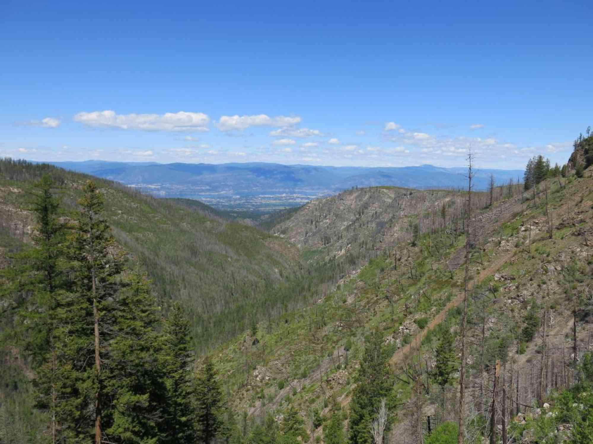
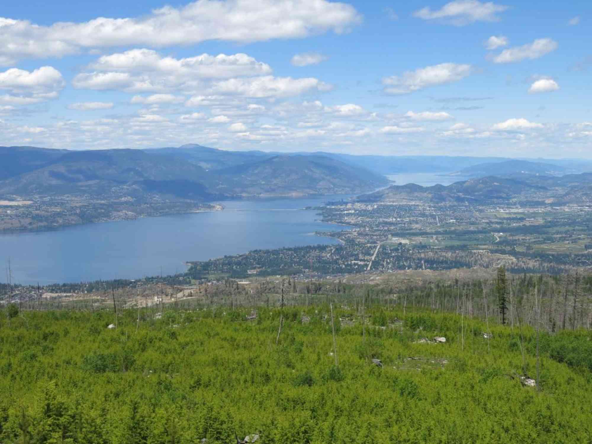
At 19km, you'll reach the Bellevue Trestle - the first one in 7 km. Shortly after that at 25 km, the forest opens up for a stunning view of downtown Kelowna, Kelowna Mountain's suspension bridges, and Cedar Mountain Crags.
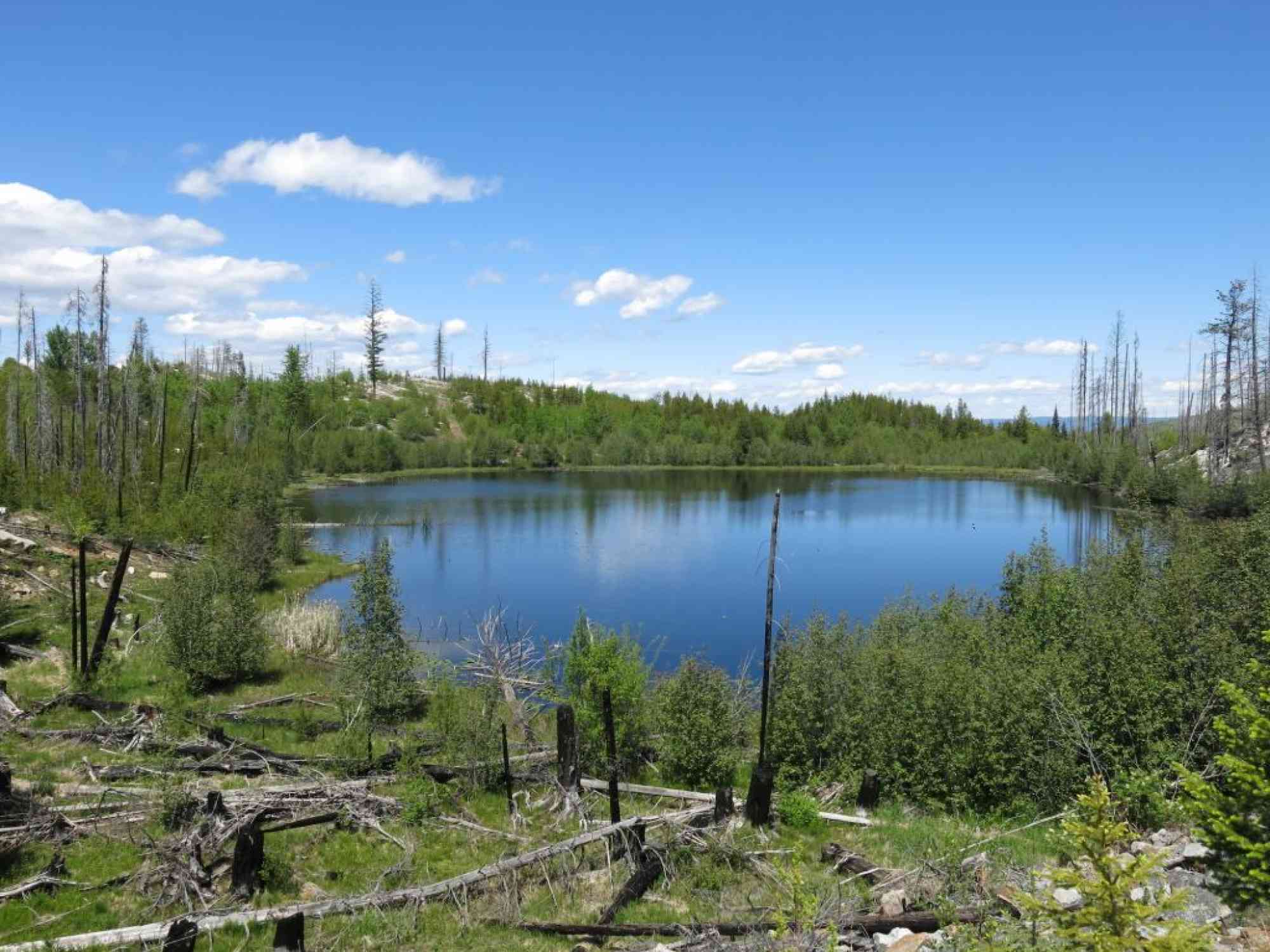
Lebanon Lake, around the 30 km mark, is comparable to a small pond. The low-lying surrounding hills, and new growth trees since the 2003 fires make for a very picturesque "truly Canadian" photo. Between here and Chute Lake, Okanagan Mountain Park will be to your immediate right. Watch for moose at the small watering holes, and rattle snakes on the trail!
Take a lunch break at Chute Lake Resort at 36 km (open year round), and bask in the glory that the hardest part of the trail is now behind you. The resort offers toilets, camp sites, and a variety of other services. Be forewarned that they do charge a picnicking fee of $5 if you wish to use their tables. I suggest heading up the road less than 1 km and sitting on the bridge and eating your lunch there while overlooking the lake.
The descent begins! For most of the remaining 30 km, you will be able to coast - only peddling to maintain speed. Watch out for a slightly thicker layer of sand on the trail which can cause the occasional tire to slip a little bit.
Rock Oven Park begins at 45 km and continues for 8 km, passing by the Adra tunnel. As it has not yet been resorted, keep right at both forks to stay on the KVR! You'll be doing what feels like a bit of back-tracking here as you zig-zag your way to a lower elevation to exit into Naramata.
And since you're already on bike and in Naramata, why not take this as an opportunity to go tasting at some of the countless award-winning wineries in the area!
This trip involves 3.5 - 4 hours of initial setup getting the cars in place (dropping car in Naramata, etc.) and then getting the bikes up to Myra Station. There are shuttles from Penticton that will drive you back to Kelowna, but that also means another 15 km of cycling at the end!


Route
Kids & Pets
Features
Address
Driving Time
From Downtown Kelowna, approximate travel time by car is 38 min.
Notable GPS Co-ordinates
Detailed Directions
1. Drive two cars (one with bike racks) to the Naramata, BC exit on Smethurst Rd, Naramata. Googling "1430 Smethurst Rd, Naramata" will get you close. Drive another few hundred meters up the road.
2. Once in Kelowna, drive to Myra Station (careful not to go to Ruth Station via June Springs Rd) with the bikes on another car with racks.
2a) Start on Harvey/Highway 97 in downtown Kelowna heading east.
2b) Turn RIGHT on Gordon
2c) Turn LEFT on KLO Road.
2d) Keep RIGHT onto McCulloch Rd where it intersects with East Kelowna Road.
2e) Turn RIGHT to stay onto McCulloch Rd at the Reekie/Ross Rd intersection.
2f) Cross over KLO Creek, and head up the hill.
2g) Turn RIGHT on Myra Forest Service Rd (signs to trestles)
2h) Approx 8.4 km later up this washboard-style dirt road, arrive at the Myra Station entrance.
3. Cycle to Naramata, BC.
4. Drive back to Myra Station and pickup the other car!
Google Directions
Use our written directions in preference to the Google directions below as they are likely more accurate.
We have a downloadable GPS map for this trail!
Last Updated on Thursday, March 23, 2023
Need help using it? See our FAQ.
Leave a comment
You must Login to post a comment!