
Black Mountain (2023 Summit)
Black Mountain (2023 Summit)
Black Mountain
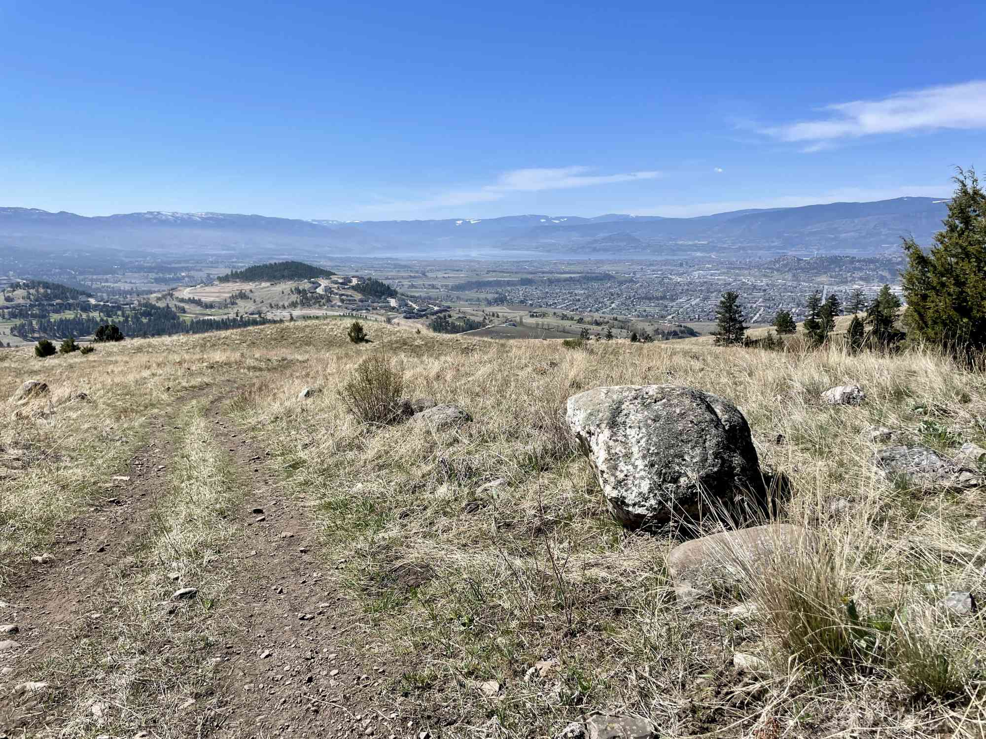
This new route to the summit of Black (Knight) Mountain begins at the official trailhead on Swainson Rd. While only the lower part of the trail network is officially complete, it is likely this will be very close to the official route that will be in place when the park fully opens. It is unclear if this route crosses private property, as there are a couple signs mid-route, but word is that the RDCO purchased this land. Traverse at your own risk prior to the trail being officially opened.
Begin the journey meandering through the bald grassland hills at the base of the mountain before ascending via 4x4ing track to the true summit and cell tower. 270° panoramic views of Kelowna and Highway 33.


Route
Kids & Pets
Features
Address
Driving Time
From Downtown Kelowna, approximate travel time by car is 24 min.
Notable GPS Co-ordinates
Detailed Directions
1) From downtown Kelowna, head north-east towards Vernon on Highway 97.
2) Turn RIGHT onto Highway 33 and follow right to the end of Rutland.
3) Turn LEFT onto Muir Rd
4) Immediately turn RIGHT onto McKenzie Rd
5) After 650m, turn RIGHT to stay on McKenzie Rd
6) After 1.4 km, turn RIGHT onto Swainson Rd
7) Drive approx 1.8 km to the destination and parking lot on the left.
Google Directions


Duration Calculator
The metrics for this trail have been converted to round-trip formation for distance and elevation gain/descent if necessary.
We have a downloadable GPS map for this trail!
Last Updated on Sunday, January 26, 2025
Need help using it? See our FAQ.
Leave a comment
You must Login to post a comment!